New MCSC Geospatial Tool Supports Strategic Decision-making for Decarbonizing Trucking Fleets
Posted by the MIT Climate & Sustainability Consortium
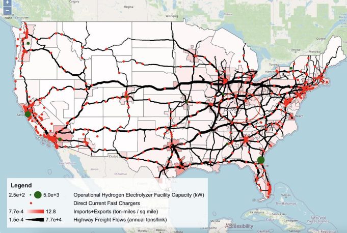
The MCSC’s Geospatial Decision Support Tool helps trucking industry stakeholders and fleet owners assess where and how best to decarbonize their fleets by transitioning to low-carbon energy carriers. Developed by Danika MacDonell, MCSC Impact Fellow, alongside AeroAstro’s Florian Allroggen, Research Scientist, and Micah Borrero S.B. ‘24, undergraduate researcher, the tool hosts public freight-flow and emissions-related data for trucking, focusing on in-depth analysis and visualization of freight analysis framework (FAF5) data, complemented by supporting information from many other sources – such as the US Department of Transportation’s Bureau of Transportation Statistics geographic datasets, the US Environmental Protection Agency’s emissions and generation resource integrated database, and the US Energy Information Administration’s electricity data. Together, the information represents a robust geospatial picture of regional freight flow densities, planned and available infrastructure, emission intensities, and relevant regulations and incentives – leading to strategic decision-making support for fleet transitions.