MIT student team CERBERUZ wins NASA LunaRecycle Centennial Challenge, turning lunar trash into tools
Establishing a human presence on the moon will require state-of-the-art spacecraft, spacesuits, life-support systems, and some of the most sophisticated technology humans have ever built. It will also require figuring out where to put the garbage.
A future lunar outpost will receive a steady stream of supplies from Earth, bringing packaging and other materials that could quickly become a mountain of waste. Meanwhile, astronauts will need tools, replacement parts, and materials to maintain the outpost, and shipping supplies from Earth is astronomically expensive. An MIT student team has won first prize in a NASA competition for developing a way to turn that trash into useful materials for lunar living.
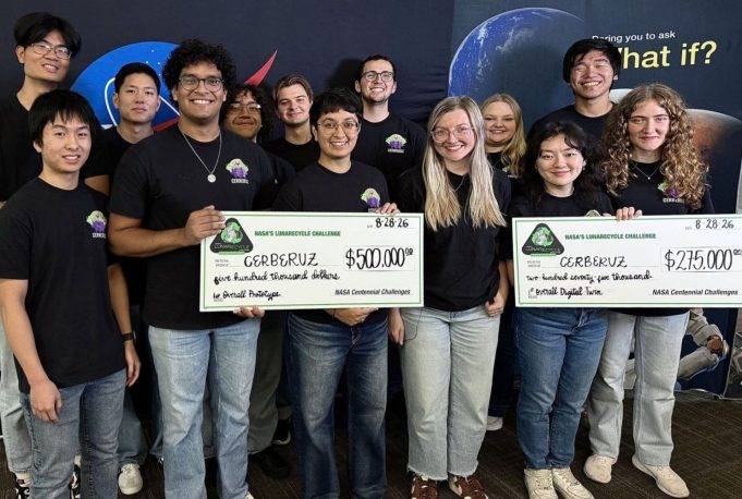
The Composites for Extraterrestrial Recycling By Engineering the Reuse and Upcycling of Zotek (CERBERUZ) team was named first-prize winner in both the Prototype and Digital Twin tracks of NASA’s LunaRecycle Challenge. The challenge — part of NASA’s Centennial Challenges series — asked participants to design and develop solutions that can reuse, recycle, or upcycle space waste and improve the sustainability of longer-duration lunar missions. Teams were encouraged to envision solutions that not only addressed recycling in deep space, but could also have applications on Earth.
The CERBERUZ team’s system turns otherwise unusable waste into new composite materials, grinding it down, melting it, and molding it into useful parts. The approach reduces the need for costly shipments from Earth and keeps bulky packaging from piling up in lunar landfills.
“Waste packaging materials will inevitably accumulate when a lunar outpost is built, and at the same time, outpost construction and maintenance will require a steady supply of new materials, including replacement parts,” says George Lordos, a research scientist in the MIT Department of Aeronautics and Astronautics and System Design and Management, and the lead advisor for the CERBERUZ team. “Recycling waste materials into such parts can help reduce materials needed to be launched from Earth.”
Waste not, want not
CERBERUZ separates non-biological waste into two streams: thermoplastics and everything else. All materials are then ground into a fine powder and mixed together. The powder mixture is loaded into an injection molding machine, where the thermoplastics melt with the remaining materials suspended in the molten plastic. The mixture is finally injected into a mold, producing high-quality composite parts that can be quickly and reliably replicated.
The team’s approach is especially notable for its treatment of Zotek F30, a closed-cell thermoset foam commonly used in aerospace packaging. Mixed thermoplastics and thermoset foams like Zotek F30 have no established recycling solutions, even on Earth. CERBERUZ takes a unique approach to this challenge by incorporating the Zotek as a reinforcing filler for the molten feedstock.
Zotek presents another peculiar engineering challenge that makes the need to break it down even more pressing: It is so lightweight that enormous quantities are needed to produce a useful mass of material. “We had big shipments of Zotek coming in, and one person can carry them on their head like it’s nothing,” says José Soto, a graduate student in AeroAstro and the team’s pre-processing lead. “The box is the size of a person.”
The team designed the process around the constraints of operating far from Earth. Because CERBERUZ uses mechanical methods powered by electricity, it doesn’t rely on water-intensive recycling processes or chemical depolymerization, and produces no secondary chemical waste. This could allow packaging and other materials delivered to a lunar outpost to become a local source of manufacturing feedstock, giving astronauts the ability to produce needed items from material they already have on hand.
“We set out to build something that would actually make sense on the moon, not just in a lab,” says Lanie McKinney, a graduate student in AeroAstro and team lead for CERBERUZ. “That means no water and no chemicals you can’t replace. Every design choice we made was driven by those constraints. And we don’t want to recycle just for recycling’s sake; we want to make useful things. Part of how we framed the problem was to create a system that can process nearly any feedstock and turn it into a wide array of components, giving more utility than producing a single item.”
Alongside the physical recycling system, the team developed DEIMOS, or Digital Environment for Intelligent Modeling of Operational Systems, a digital twin of its injection molding machine. Using data collected during actual production runs, DEIMOS models how different combinations of recycled materials and part geometries will behave during manufacturing, predicting factors including mold fill, warpage, and shrinkage risk. Ultimately, the digital twin could help astronauts determine how recycled materials will perform before committing limited resources to manufacturing a part on the moon.
Where ideas become hardware
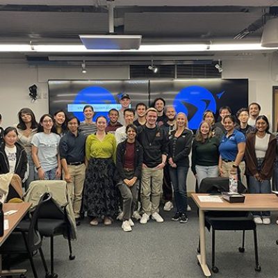
The CERBERUZ team grew out of the MIT Space Resources Workshop, a co-curricular initiative of students passionate about designing, building, and testing systems to support future moon and Mars exploration. Founded in 2017, the workshop is well-known for building teams that take on, and conquer, grand challenges in NASA-sponsored competitions.
The team brings together undergraduate and graduate students from four MIT departments: Aeronautics and Astronautics, Mechanical Engineering, Electrical Engineering and Computer Science, and Materials Science and Engineering. Professor Jeffrey Hoffman, a former NASA astronaut, and Lordos served as advisors for the team.
“What impresses me most about this team is the quality of leadership,” says Lordos. “Lanie McKinney has been an outstanding team lead, and the co-leads — Palak Patel on manufacturing and materials characterization, Lilly Etzenbach on the digital twin, and José Soto on pre-processing — have each built and managed subteams doing cutting-edge research in lunar sustainability.”
The win caps nearly two years of work on the challenge. CERBERUZ was selected as a Phase 1 winner in 2025 before advancing through Phase 2 and earning milestone prizes in both tracks on its way to the final demonstration in summer 2026. The team earned $925,000 in prize money over the course of the challenge, and hopes to reinvest their winnings in the Space Resources Workshop, funding equipment and facilities that will enable future teams to rise to ever-more-complex challenges. Those advances will help turn a return to the moon into something more permanent: a human presence, built to last.
“If we’re able to reduce the amount of waste that’s inevitably going to be left on the moon, rather than letting it pile up like a landfill,” Soto says, “we can preserve both the beauty of the moon and make exploration more efficient and sustainable. And perhaps we can inspire people back on Earth to take another look at our trash and find more ways to recycle or reuse it.”
CERBERUZ team leads are Lanie McKinney, Palak B. Patel, Lilly Etzenbach, and José Soto. Team members include Sophia Augier, Sophie Berkvist, Ariella Blackman, Keira Boone, Constantine Bulavenko, Seth Burrowes, Andrew Chen, Alex Chen, Chris Choe, Johnson Cristales, Brady Cruse, Hillel Dei, Natalie Hatzigeorgiu, Intia Ibnah, Avishai Jeselsohn, Mollie Johnson, Uma Kirk, Christopher Kwon, Jessica Meza, Juan Orrego, Giuliana Pertuz, Jordan Prawira, Brandy Romine, Dustin Wang, Madison Wood, and Adrian Yang.