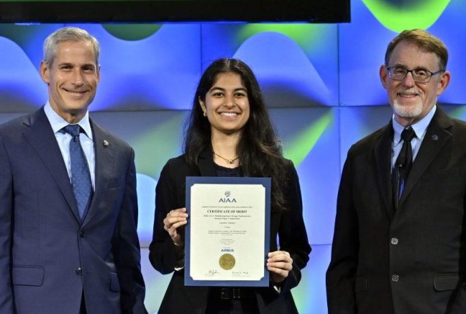
Anushka Tahiliani earns AIAA honor for propulsion modeling work with Electra.aero’s NASA AACES 2050 team
Grad student Anushka Tahiliani led the propulsion-system modeling effort for Electra.aero’s team in the NASA Advanced Aircraft Concepts for Environmental Sustainability (AACES) 2050 initiative, advancing a new framework that allows aircraft design, propulsion systems, and flight trajectories to be optimized together. AACES 2050 challenged industry and academia to develop transformative aircraft designs, propulsion technologies, and sustainability solutions for commercial aviation by 2050.
Tahiliani had previously worked with Electra at MIT, contributing to wind-tunnel testing on another aircraft concept in the Wright Brothers Wind Tunnel. She later joined Electra’s AACES 2050 team as a research assistant through her work as a graduate student researcher in the MIT Gas Turbine Laboratory, where she is advised by Professor Masha Folk.
Tahiliani’s work involved extending pyCycle, NASA’s engine-cycle modeling tool, to make propulsion analysis more robust and higher fidelity for integrated aircraft design studies. She also contributed to integrating the propulsion model into the broader aircraft design and trajectory optimization framework, allowing the full thermodynamic engine cycle to be evaluated throughout an aircraft’s mission rather than relying on the simplified models commonly used in conceptual aircraft design.
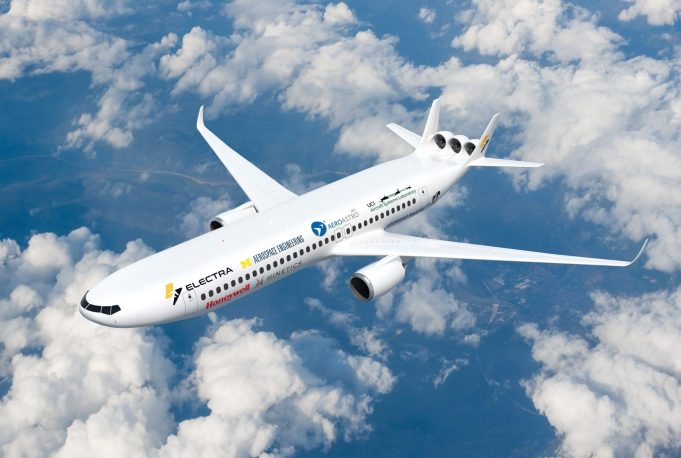
The propulsion model is part of the overall design of Electra’s AACES 2050 aircraft concept: a next-generation commercial airliner that combines a lifting “double-bubble” fuselage with a turbo-electric propulsion system. The concept explores how targeted electrification, advanced aerodynamics, and integrated airframe-propulsion design could improve the efficiency of future commercial aircraft. In the proposed configuration, gas turbine engines generate electrical power for electric tail fans that work with the aircraft’s aerodynamic design to improve overall efficiency. The team was led by Dr. Alejandra Uranga PhD ‘10, Electra’s Chief Engineer for Research and Future Concepts, who previously co-led the research at MIT that advanced the original Double Bubble concept.
“It was incredibly rewarding to have the opportunity to contribute as part of such a collaborative team,” Tahiliani says. “The development of an integrated aircraft-design framework depended on the range of expertise across the team, with collaborators from universities, industry, and research organizations.”
The methods developed through this work were presented in the paper, “Robust Approach to Engine Cycle Modeling to Enable Multidisciplinary Optimization of Advanced Aircraft,” which received First Prize in the 2026 AIAA AVIATION Forum Multidisciplinary Design Optimization Student Paper Competition. The paper is authored by Anushka Tahiliani, Hannah Hajdik (Electra), Andrew Lamkin (Supercritical), Masha Folk, and Alejandra Uranga (Electra).
“In the near term, this research and the broader framework can help engineers determine which emerging propulsion and aerodynamic technologies deliver meaningful aircraft-level benefits once weight, integration, thermal-management requirements, and operational limits are considered,” says Tahiliani. “That evidence can guide where industry and government invest and which aircraft configurations should be pursued.”